File:Map A.png
Jump to navigation
Jump to search

Size of this preview: 800 × 592 pixels. Other resolutions: 320 × 237 pixels | 1,896 × 1,403 pixels.
Original file (1,896 × 1,403 pixels, file size: 683 KB, MIME type: image/png)
Summary
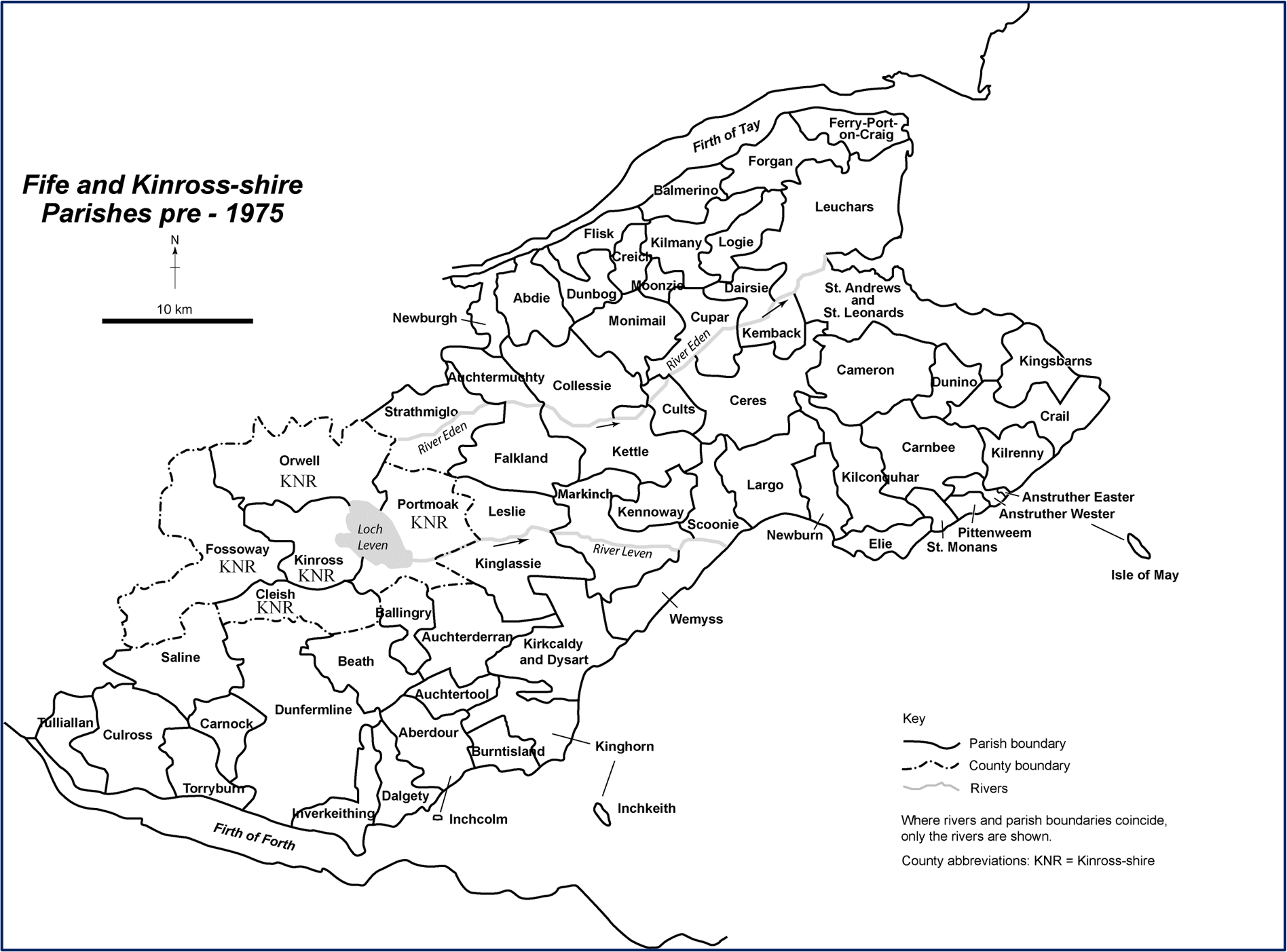
Fife and Kinross-shire parishes pre-1975. Map A (page 466) in Playfair and Burgess, where it was reproduced with permission from Taylor, Place-Names, page 6.
File history
Click on a date/time to view the file as it appeared at that time.
| Date/Time | Thumbnail | Dimensions | User | Comment | |
|---|---|---|---|---|---|
| current | 11:46, 25 December 2021 | | 1,896 × 1,403 (683 KB) | Ross (talk | contribs) | Fife and Kinross-shire parishes pre-1975. Map A (page 465) in Playfair and Burgess, where it was reproduced with permission from Taylor, ''Placenames''. |
You cannot overwrite this file.
File usage
The following page uses this file: