File:Map C+.png
Jump to navigation
Jump to search
Size of this preview: 800 × 445 pixels. Other resolutions: 320 × 178 pixels | 1,554 × 864 pixels.
Original file (1,554 × 864 pixels, file size: 259 KB, MIME type: image/png)
Summary
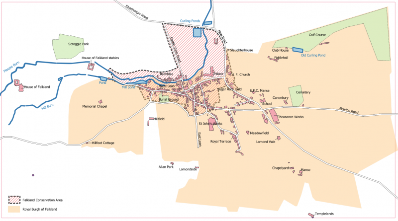
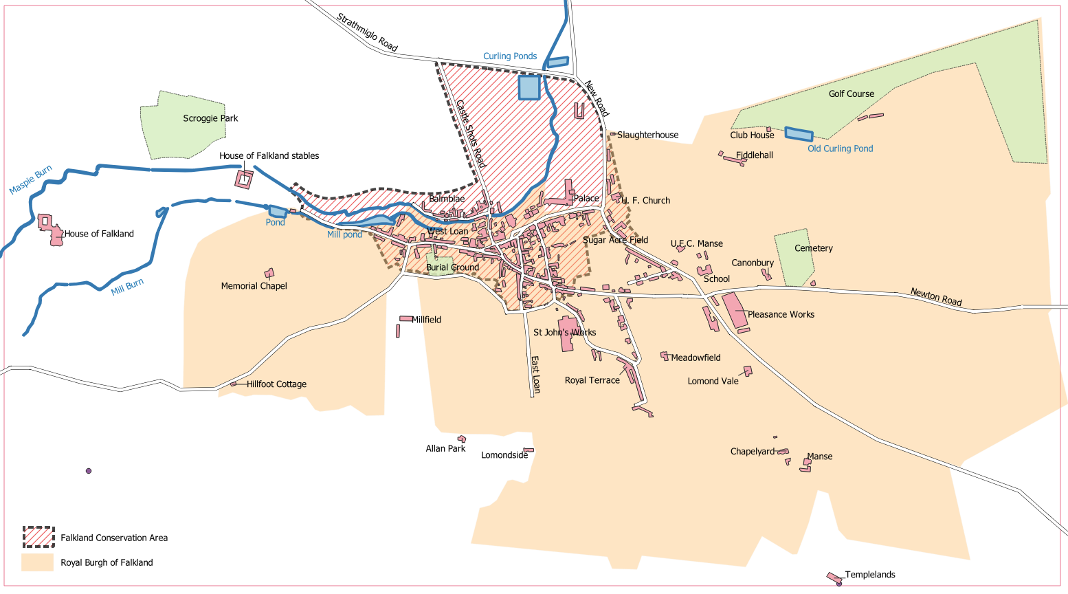
Map of the Royal Burgh of Falkland showing the Conservation Area. (c) Ross Burgess, 2021. Enhanced version of Map C from Playfair and Burgess
File history
Click on a date/time to view the file as it appeared at that time.
| Date/Time | Thumbnail | Dimensions | User | Comment | |
|---|---|---|---|---|---|
| current | 17:01, 23 January 2021 | | 1,554 × 864 (259 KB) | Ross (talk | contribs) | Map of the Royal Burgh of Falkland showing the Conservation Area. (c) Ross Burgess, 2021. |
You cannot overwrite this file.
File usage
The following 4 pages use this file:
- Falkland Conservation Area
- Map C
- Royal Burgh of Falkland
- File:Map 3a.PNG (file redirect)