Difference between revisions of "Map C"
Jump to navigation
Jump to search
| Line 1: | Line 1: | ||
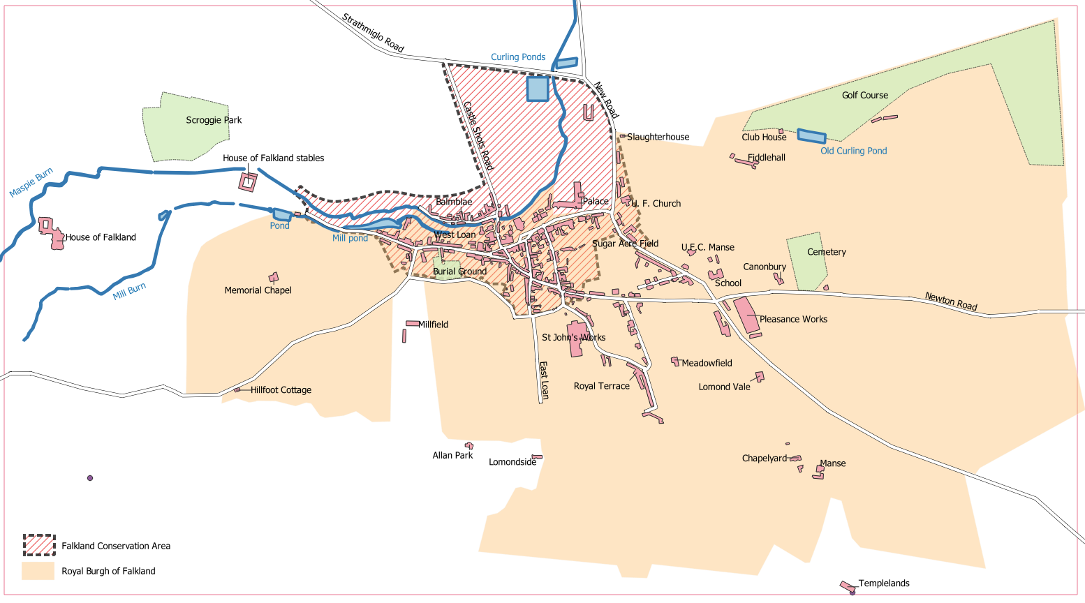
The Royal Burgh of Falkland: '''Map C''' from [[Playfair and Burgess]], ''Falkland and its people 1901–1913'' | The Royal Burgh of Falkland: '''Map C''' from [[Playfair and Burgess]], ''Falkland and its people 1901–1913'' | ||
| − | [[File:Map C.png]] | + | |
| + | [[File:Whatever.JPG]] | ||
| + | </div>[[File:Map C.png]] | ||
Original black and white version from page 468 of [[Playfair and Burgess]] | Original black and white version from page 468 of [[Playfair and Burgess]] | ||
| − | [[File:Map C+.png]] | + | <div class="res-img" style="max-width:100%; height:auto;">[[File:Map C+.png]]</div> |
Enhanced version for a Falkland Society lecture, in colour and with Falkland Conservation Area boundary added. | Enhanced version for a Falkland Society lecture, in colour and with Falkland Conservation Area boundary added. | ||
[[Category:Maps]] | [[Category:Maps]] | ||
[[Category:Falkland Conservation Area]] | [[Category:Falkland Conservation Area]] | ||
Revision as of 17:25, 22 December 2021
The Royal Burgh of Falkland: Map C from Playfair and Burgess, Falkland and its people 1901–1913

Original black and white version from page 468 of Playfair and Burgess

Enhanced version for a Falkland Society lecture, in colour and with Falkland Conservation Area boundary added.