Difference between revisions of "Map C"
Jump to navigation
Jump to search
(Created page with "The historic centre of Falkland: '''Map C''' from Playfair and Burgess, ''Falkland and its people 1901–1913'' See Playfair and Burgess for an explanation of the numb...") |
|||
| (18 intermediate revisions by 2 users not shown) | |||
| Line 1: | Line 1: | ||
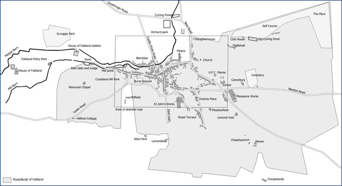
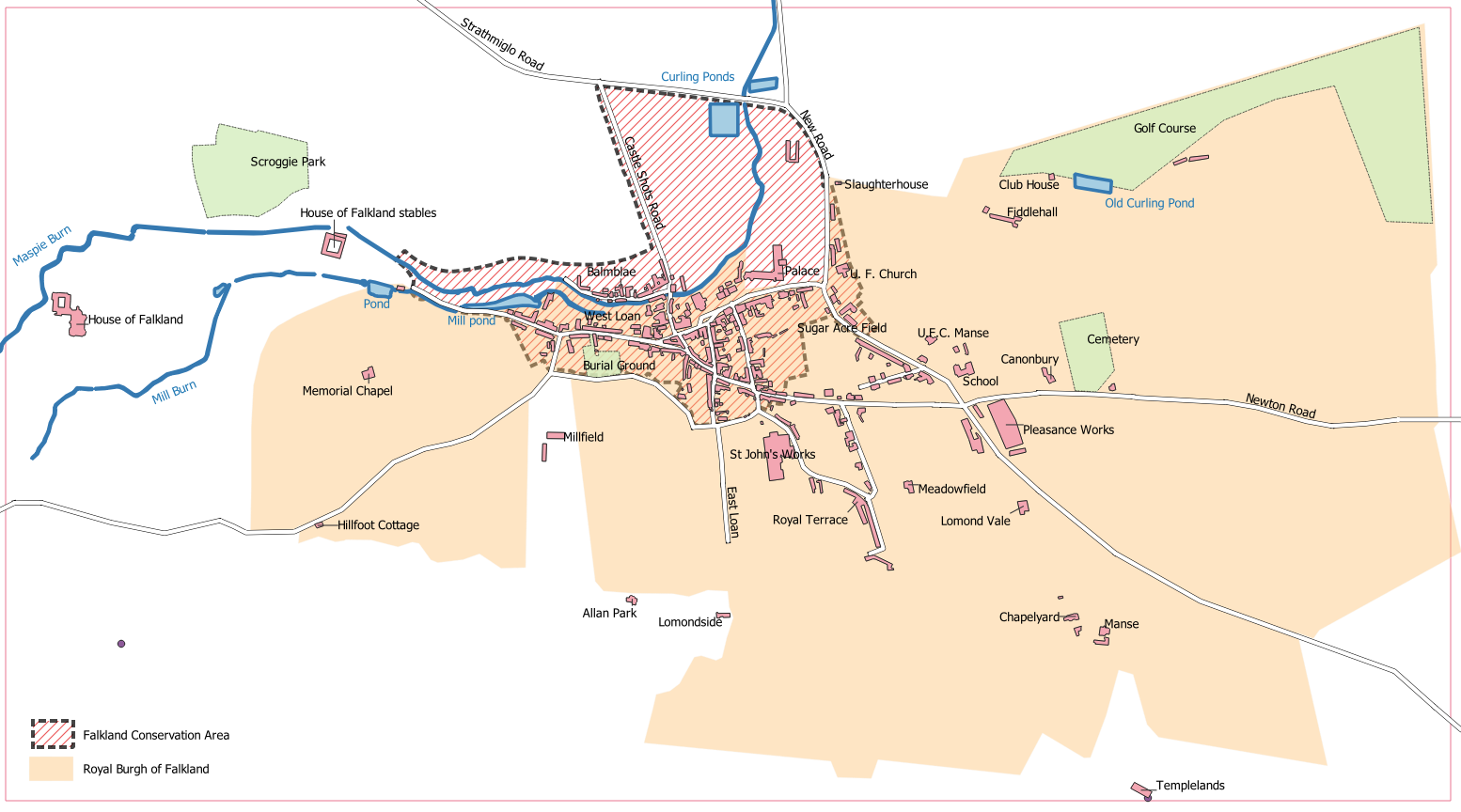
| − | The | + | The Royal Burgh of Falkland: '''Map C''' from [[Playfair and Burgess]], ''Falkland and its people 1901–1913''. |
| + | |||
| + | Note that this map shows buildings as existing around 1913, including some that no longer exist, and excluding many that have been built in the last hundred years. | ||
[[File:Map C.png]] | [[File:Map C.png]] | ||
| + | <br>Original black and white version from page 468 of [[Playfair and Burgess]]. | ||
| + | The outlined area shows the extent of the detailed map ([[Map D]]) | ||
| + | |||
| + | [[File:Map C+.png]] | ||
| + | <br>Enhanced version for a Falkland Society lecture, in colour and with Falkland Conservation Area boundary added. | ||
[[Category:Maps]] | [[Category:Maps]] | ||
[[Category:Falkland Conservation Area]] | [[Category:Falkland Conservation Area]] | ||
Latest revision as of 14:51, 4 February 2022
The Royal Burgh of Falkland: Map C from Playfair and Burgess, Falkland and its people 1901–1913.
Note that this map shows buildings as existing around 1913, including some that no longer exist, and excluding many that have been built in the last hundred years.

Original black and white version from page 468 of Playfair and Burgess.
The outlined area shows the extent of the detailed map (Map D)

Enhanced version for a Falkland Society lecture, in colour and with Falkland Conservation Area boundary added.