Rottenrow: Difference between revisions
Jump to navigation
Jump to search
| Line 2: | Line 2: | ||
==Further images== | ==Further images== | ||
<gallery mode=packed style="text-align:left"> | <gallery mode=packed style="text-align:left"> | ||
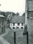
File:Rotten Row.jpg|Rotten Row 1960s, with [[Stag House]], and ruins of [[ | File:Rotten Row.jpg|Rotten Row 1960s, with [[Stag House]], and ruins of [[Bruce's Mill]] | ||
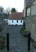
File:Rotten Row 2021.JPG|Rotten Row and [[Stag House]], 2021 | |||
</gallery> | </gallery> | ||
[[Category:Streets and roads]] | [[Category:Streets and roads]] | ||
[[Category:Royal Burgh of Falkland]] | [[Category:Royal Burgh of Falkland]] | ||
[[Category:Falkland Conservation Area]] | [[Category:Falkland Conservation Area]] | ||
Revision as of 14:31, 17 December 2021

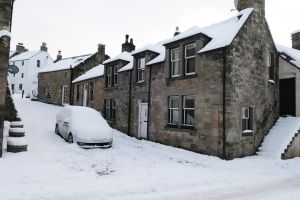
Rottenrow is a very short street, running between Falkland High Street and Brunton Street/South Street West. The west side of the street is occupied by several former houses, now all part of Clardale. The east side of the street has no houses as such, being taken up with the side of Thistle House and its garden.
Further images
-
Rotten Row 1960s, with Stag House, and ruins of Bruce's Mill
-
Rotten Row and Stag House, 2021

