Rottenrow: Difference between revisions
Jump to navigation
Jump to search
No edit summary |
No edit summary |
||
| Line 3: | Line 3: | ||
'''See map:''' [[Map T]] (17) | '''See map:''' [[Map T]] (17) | ||
==Buildings== | ==Buildings== | ||
The west side of the street is occupied by several former houses, now all part of [[Clardale]]. The east side of the street has no houses as such, being taken up with the side of [[Thistle House]] and its garden. | The west side of the street is occupied by several former houses, one of which (nearest the High Street, was formerly [[Colin Herd's shop]]. These are now all part of [[Clardale]]. The east side of the street has no houses as such, being taken up with the side of [[Thistle House]] and its garden. | ||
==Further images== | ==Further images== | ||
<gallery mode=packed style="text-align:left" widths=300px heights=200px> | <gallery mode=packed style="text-align:left" widths=300px heights=200px> | ||
Revision as of 10:42, 8 February 2022

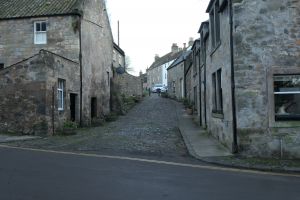
Rottenrow, or Rotten Row, is a very short street, running between Falkland High Street and Brunton Street/South Street West.
See map: Map T (17)
Buildings
The west side of the street is occupied by several former houses, one of which (nearest the High Street, was formerly Colin Herd's shop. These are now all part of Clardale. The east side of the street has no houses as such, being taken up with the side of Thistle House and its garden.
Further images
-
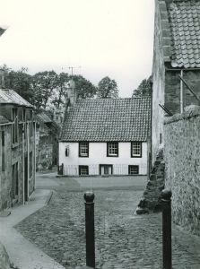
Rotten Row and Stag House, 1960s, ruins of Bruce's Mill just visible
-
Rotten Row and Stag House, 2021
-
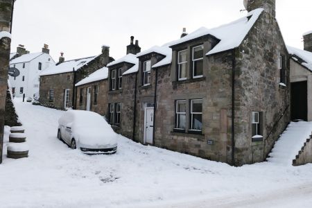
Rotten Row in snow


