Brunton Street: Difference between revisions
Jump to navigation
Jump to search
No edit summary |
No edit summary |
||
| (3 intermediate revisions by the same user not shown) | |||
| Line 2: | Line 2: | ||
The east end of Brunton Street is crossed by [[Cross Wynd]]. | The east end of Brunton Street is crossed by [[Cross Wynd]]. | ||
The west end of Brunton Street is crossed by [[Sharps Close]] and [[Rotten Row]]. | |||
'''See map:''' [[Map T]] (15); [[Map D]] (56) | |||
'''what3words:''' [https://what3words.com/ordinary.acoustics.reporter ///ordinary.acoustics.reporter] | |||
==Buildings== | |||
All the buildings on the south side of Brunton Street were demolished to form [[Brunton Green]]. | All the buildings on the south side of Brunton Street were demolished to form [[Brunton Green]]. | ||
| Line 20: | Line 27: | ||
[[Category:Royal Burgh of Falkland]] | [[Category:Royal Burgh of Falkland]] | ||
[[Category:Falkland Conservation Area]] | [[Category:Falkland Conservation Area]] | ||
Latest revision as of 17:16, 8 February 2024
Brunton Street is part of the secondary east-west axis of Falkland, which includes South Street West, Brunton Street, Horsemarket and South Street.
The east end of Brunton Street is crossed by Cross Wynd.
The west end of Brunton Street is crossed by Sharps Close and Rotten Row.
See map: Map T (15); Map D (56)
what3words: ///ordinary.acoustics.reporter
Buildings
All the buildings on the south side of Brunton Street were demolished to form Brunton Green.
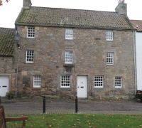
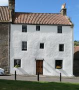
The houses in Brunton Street (from West to East) are:
Further images
-
Brunton House
-
Wester Brunton

