Map C: Difference between revisions
Jump to navigation
Jump to search
Created page with "The historic centre of Falkland: '''Map C''' from Playfair and Burgess, ''Falkland and its people 1901–1913'' See Playfair and Burgess for an explanation of the numb..." |
No edit summary |
||
| Line 2: | Line 2: | ||
[[File:Map C.png]] | [[File:Map C.png]] | ||
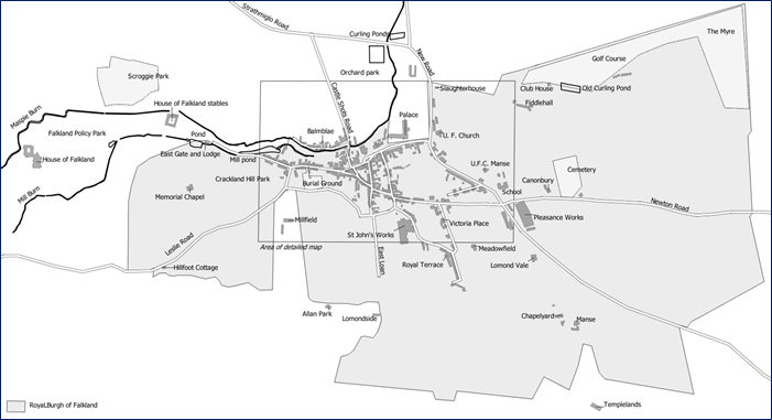
Original black and white version from page 468 of [[Playfair and Burgess]] | |||
[[File:Map C+.png]] | |||
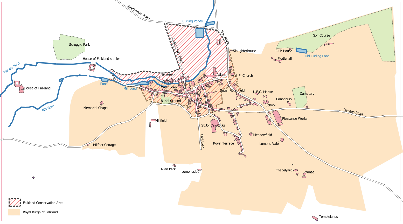
Enhanced version for a Falkland Society lecture, in colour and with Falkland Conservation Area boundary added. | |||
[[Category:Maps]] | [[Category:Maps]] | ||
[[Category:Falkland Conservation Area]] | [[Category:Falkland Conservation Area]] | ||
Revision as of 17:02, 22 December 2021
The historic centre of Falkland: Map C from Playfair and Burgess, Falkland and its people 1901–1913 See Playfair and Burgess for an explanation of the numbered items.
 Original black and white version from page 468 of Playfair and Burgess
 Enhanced version for a Falkland Society lecture, in colour and with Falkland Conservation Area boundary added.