Difference between revisions of "Cross Wynd"
| Line 32: | Line 32: | ||
<gallery mode=packed> | <gallery mode=packed> | ||
File:Cross Wynd houses before demolition 1954.PNG|Houses on the west side, 1954 prior to demolition | File:Cross Wynd houses before demolition 1954.PNG|Houses on the west side, 1954 prior to demolition | ||
| + | File:Cross Wynd 2.jpeg|Northern end of Cross Wynd | ||
| + | File:Cross Wynd.JPG|Another view | ||
| + | File:Cross Wynd2.JPG|Another view | ||
</gallery> | </gallery> | ||
Revision as of 12:54, 5 January 2022

Cross Wynd runs from north to south, at right angles to the High Street, It starts at High Street, continues to a cross-roads separating Brunton Street and Horsemarket and ends at Back Dykes.
Much of the west side of Cross Wynd was demolished to form Brunton Green.
Until the drainage works in 1901, a burn ran down the centre of the Wynd, bringing yellow sand from the hill. Housewives would bring their pots and pans here to wash and scour them.[1]
See map: Map T (14); Map D (54)
Buildings
From north to south, the houses on the east side are:
- Seton House
- The Corrie (incorporating Bonnie Boo Kids)
- Cobblestones
- "House (Mrs Lilias Chisholm), Cross Wynd" (not identified)
- The Wynd
- Wynd Cottage (1 Parliament Square)
- 2 Parliament Square
- The Smiddy (3 Parliament Square
- The Shien (4 Parliament Square)
- Cross Wynd Cottage
(Horsemarket is here)
- Thistle Cottage (round the corner)
- Ivy Cottage
- Arthur Place
- Ashgrove Cottage
Further references
"In Cross Wynd ... harled C17 and C18 houses, one [The Corrie] with a round-headed blind window in the chimney gablet, another [The Corrie (southern extension)] dated 1686 and a third [Cobblestones] dated 1764."[2]
Notes
- ↑ A Falkland Guide, page 9.
- ↑ Gifford, Fife, page 220.
Further images
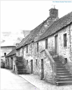
Houses on the west side, 1954 prior to demolition
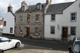
Northern end of Cross Wynd
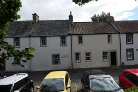
Another view
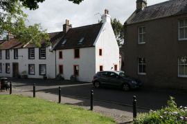
Another view


