Difference between revisions of "File:Map C+.png"
Jump to navigation
Jump to search
| Line 2: | Line 2: | ||
Map of the [[Royal Burgh of Falkland]] showing the Conservation Area. (c) Ross Burgess, 2021. | Map of the [[Royal Burgh of Falkland]] showing the Conservation Area. (c) Ross Burgess, 2021. | ||
Enhanced version of Map C from [[Playfair and Burgess]] | Enhanced version of Map C from [[Playfair and Burgess]] | ||
| + | [[Category:Maps]] | ||
Revision as of 17:09, 22 December 2021
Summary
Map of the Royal Burgh of Falkland showing the Conservation Area. (c) Ross Burgess, 2021. Enhanced version of Map C from Playfair and Burgess
File history
Click on a date/time to view the file as it appeared at that time.
| Date/Time | Thumbnail | Dimensions | User | Comment | |
|---|---|---|---|---|---|
| current | 17:01, 23 January 2021 | 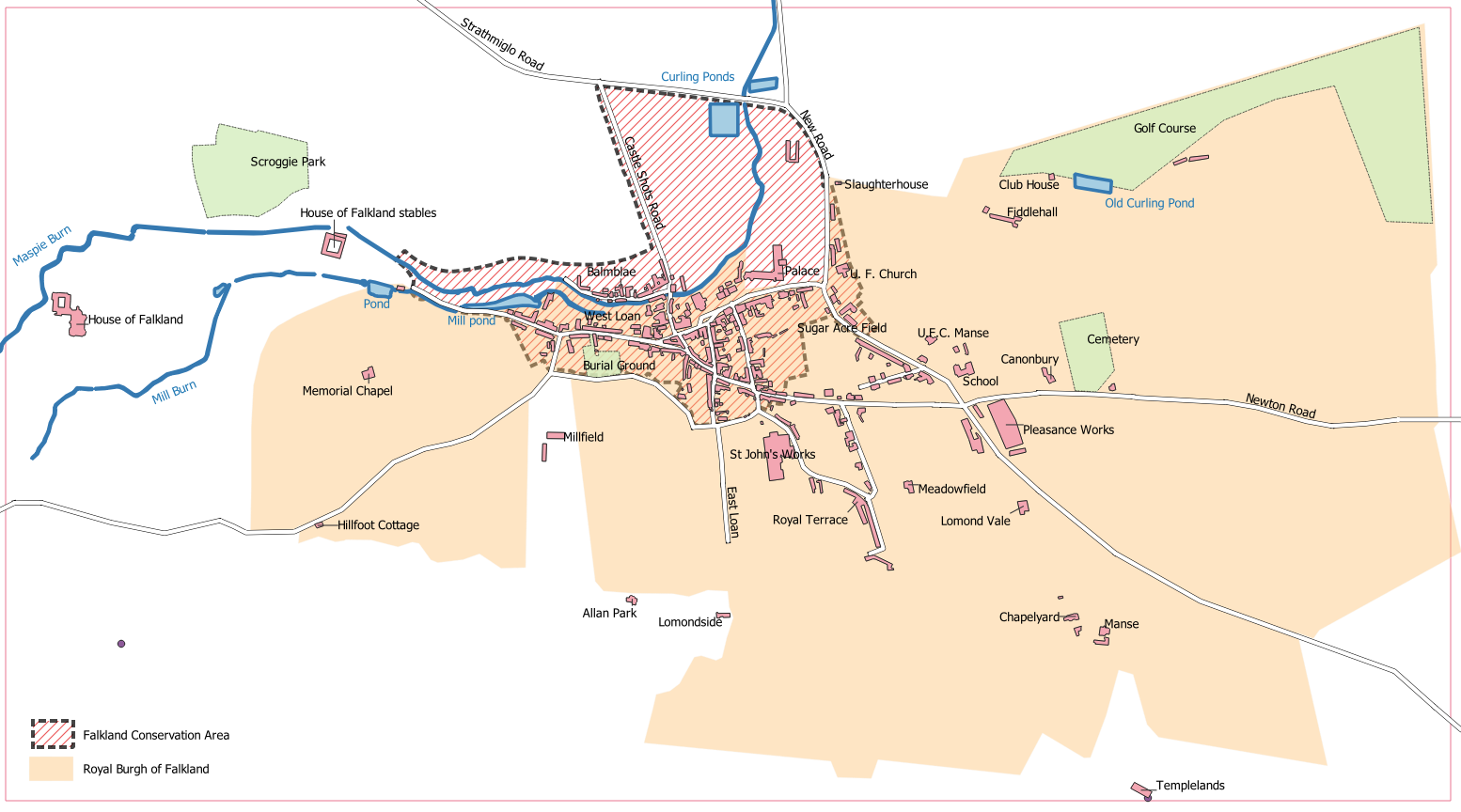 | 1,554 × 864 (259 KB) | Ross (talk | contribs) | Map of the Royal Burgh of Falkland showing the Conservation Area. (c) Ross Burgess, 2021. |
You cannot overwrite this file.
File usage
The following 4 pages use this file:
- Falkland Conservation Area
- Map C
- Royal Burgh of Falkland
- File:Map 3a.PNG (file redirect)