Playfair and Burgess: Difference between revisions
Jump to navigation
Jump to search
No edit summary |
|||
| Line 128: | Line 128: | ||
==Selected sites outwith the parish== | ==Selected sites outwith the parish== | ||
*[[Falkland Road Station]] | *[[Falkland Road Station]] | ||
*[[Lathrisk]] | *[[Lathrisk]] | ||
Revision as of 08:40, 26 December 2021

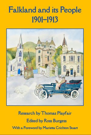
Thomas Playfair (research) and Ross Burgess (editor), Falkland and its people 1901–1913 (Falkland: the Falkland Society, 2020) - published December 2020.
It contains four maps:
- Map A: Fife and Kinross-shire parishes pre-1975
- Map B: The Parish of Falkland
- Map C: The Royal Burgh of Falkland
- Map D: The historic centre of Falkland
The book lists the following buildings, streets, and other features.
Central area
Items marked * are outwith the Royal Burgh
- West Loan
- Viewhill House (West Port)
- West Port
- Lomond Cottage
- Mill Lade
- Balmblae *
- Bruce Buildings
- High Street West
- Police Station
- Turning Mill
- Mill Wynd
- Balmblae Burn
- Gas works
- Castle-Shots Road *
- Stag Inn
- Bryce’s store
- Co-op store
- Parish Church
- Falkland Cross
- Fountain
- Commercial Hotel
- Town Hall
- Saddlers
- Maspie House
- St Andrew’s House
- British Linen Bank
- Bruce Arms
- High Street
- Temperance Hotel (High Street)
- Old house opposite Palace
- East Port
- Falkland Palace *
- Slaughter house
- Kinnes Cottage
- New Road
- United Free Church
- Dovecot Farm
- Pleasance
- United Free Manse
- Public School
- Juniper Villa
- Temperance Hotel (Liquorstane)
- South Street
- Drill Hall
- Sugar Acre Field
- Lomondside House
- Victoria Place
- Well Brae
- St John’s Works
- East Loan
- Back Wynd
- Horsemarket
- Lomond Tavern
- Cross Wynd
- Brunton House
- Brunton Street
- Post Office (Cross Wynd)
- Colin Herd’s Shop
- Reading Room
- Burying ground
- Millfield *
- Leslie Road
- Crackland Hillpark