Playfair and Burgess: Difference between revisions
Jump to navigation
Jump to search
| (15 intermediate revisions by 2 users not shown) | |||
| Line 1: | Line 1: | ||
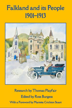
[[File:Falkland and its people front.jpg|thumb|Front cover of the book]]Thomas Playfair (research) and Ross Burgess (editor), '''''Falkland and its people 1901–1913''''' (Falkland: the Falkland Society, 2020) - published December 2020. | [[File:Falkland and its people front.jpg|thumb|Front cover of the book]]Thomas Playfair (research) and Ross Burgess (editor), '''''Falkland and its people 1901–1913''''' (Falkland: the Falkland Society, 2020) - published December 2020. | ||
It contains four maps: | |||
*[[Map A]]: Fife and Kinross-shire parishes pre-1975 | |||
*[[Map B]]: The Parish of Falkland | |||
*[[Map C]]: The Royal Burgh of Falkland | |||
*[[Map D]]: The historic centre of Falkland | |||
The book lists the following buildings, streets, and other features. | The book lists the following buildings, streets, and other features. | ||
==Central area== | ==Central area== | ||
The numbers relate to the numbered spots on Map D of the book (page 469). | |||
The numbers relate to the numbered spots on | |||
Items marked * are outwith the Royal Burgh | Items marked * are outwith the Royal Burgh | ||
{{columns-list|3| | {{columns-list|3| | ||
#[[West Loan]] | #[[West Loan]] | ||
| Line 67: | Line 71: | ||
#[[Brunton Street]] | #[[Brunton Street]] | ||
#[[Post Office (Cross Wynd)]] | #[[Post Office (Cross Wynd)]] | ||
#[[Colin Herd’s | #[[Colin Herd’s shop]] | ||
#[[Reading Room]] | #[[Reading Room]] | ||
#[[Burying ground]] | #[[Burying ground]] | ||
| Line 76: | Line 80: | ||
==The rest of the Royal Burgh== | ==The rest of the Royal Burgh== | ||
{{columns-list|3| | |||
*[[Canonbury]] | *[[Canonbury]] (later the Manse, now 1 Newton road) | ||
*[[Cemetery ]] | *[[Cemetery ]] | ||
*[[Chapelyard House]] | *[[Chapelyard House]] | ||
| Line 84: | Line 88: | ||
*[[Hillfoot Cottage]] | *[[Hillfoot Cottage]] | ||
*[[Lomondvale]] | *[[Lomondvale]] | ||
*The Manse (now [[Chapelyard]] | *The Manse (now [[Chapelyard]]) | ||
*[[Memorial Chapel]] | *[[Memorial Chapel]] | ||
*[[Mill Burn]] | *[[Mill Burn]] | ||
| Line 98: | Line 102: | ||
==The rest of the Parish of Falkland== | ==The rest of the Parish of Falkland== | ||
{{columns-list|3| | |||
*[[Annfield]] | *[[Annfield]] | ||
*[[Ballo]] | *[[Ballo]] | ||
| Line 126: | Line 130: | ||
==Selected sites outwith the parish== | ==Selected sites outwith the parish== | ||
*[[Dunshalt]] | |||
*[[Easter Cash]] | |||
*[[Falkland Road Station]] | *[[Falkland Road Station]] | ||
*[[Lathrisk]] | *[[Lathrisk]] | ||
*[[Nochnary]] | |||
*[[Plains]] | |||
*[[Wester Cash]] | |||
[[Category:Mentioned in ''Falkland and its People 1901–1913''| ]] | [[Category:Mentioned in ''Falkland and its People 1901–1913''| ]] | ||
[[Category:Books]] | [[Category:Books]] | ||
[[Category:Lists]] | [[Category:Lists]] | ||
Latest revision as of 16:46, 9 February 2022

Thomas Playfair (research) and Ross Burgess (editor), Falkland and its people 1901–1913 (Falkland: the Falkland Society, 2020) - published December 2020.
It contains four maps:
- Map A: Fife and Kinross-shire parishes pre-1975
- Map B: The Parish of Falkland
- Map C: The Royal Burgh of Falkland
- Map D: The historic centre of Falkland
The book lists the following buildings, streets, and other features.
Central area
The numbers relate to the numbered spots on Map D of the book (page 469).
Items marked * are outwith the Royal Burgh
- West Loan
- Viewhill House (West Port)
- West Port
- Lomond Cottage
- Mill Lade
- Balmblae *
- Bruce Buildings
- High Street West
- Police Station
- Turning Mill
- Mill Wynd
- Balmblae Burn
- Gas works
- Castle-Shots Road *
- Stag Inn
- Bryce’s store
- Co-op store
- Parish Church
- Falkland Cross
- Fountain
- Commercial Hotel
- Town Hall
- Saddlers
- Maspie House
- St Andrew’s House
- British Linen Bank
- Bruce Arms
- High Street
- Temperance Hotel (High Street)
- Old house opposite Palace
- East Port
- Falkland Palace *
- Slaughter house
- Kinnes Cottage
- New Road
- United Free Church
- Dovecot Farm
- Pleasance
- United Free Manse
- Public School
- Juniper Villa
- Temperance Hotel (Liquorstane)
- South Street
- Drill Hall
- Sugar Acre Field
- Lomondside House
- Victoria Place
- Well Brae
- St John’s Works
- East Loan
- Back Wynd
- Horsemarket
- Lomond Tavern
- Cross Wynd
- Brunton House
- Brunton Street
- Post Office (Cross Wynd)
- Colin Herd’s shop
- Reading Room
- Burying ground
- Millfield *
- Leslie Road
- Crackland Hillpark
The rest of the Royal Burgh
- Canonbury (later the Manse, now 1 Newton road)
- Cemetery
- Chapelyard House
- Fiddlehall
- Golf Course
- Hillfoot Cottage
- Lomondvale
- The Manse (now Chapelyard)
- Memorial Chapel
- Mill Burn
- Mill Green
- Mill Pond
- Meadowfield
- Newton Road
- Orchard Park
- Pleasance Works
- Royal Terrace
- The Myre